Convenience store nearby Walgreens
United States
Convenience store nearby Walgreens
Walgreens
3082, Avenue U, 11229, Kings County, New York, US Соединенные Штаты Америки
contacts phone
:
+1 347-783-5752
website:
www.walgreens.com
Latitude:
40.6008718
, Longitude:
-73.9358736
larger map & directions
read more
nearest Convenience store
411 m
Gra Convenient Inc
2950 Avenue U, Brooklyn
Convenience store
read more
590 m
7-Eleven
3342 Nostrand Avenue, Brooklyn
Convenience store
read more
923 m
Nostrand Store Inc
3700 Nostrand Avenue, Brooklyn
Convenience store
read more
1.028 km
Chun Jin 99¢ Up
2315 Avenue U, Brooklyn
Convenience store
read more
1.076 km
7-Eleven
3768-3778 Nostrand Avenue, Brooklyn
Convenience store
read more
1.388 km
Plaza Convenience Store Inc
4117 Avenue U, Brooklyn
Convenience store
read more
1.454 km
7-Eleven
2474 Flatbush Avenue, Brooklyn
Convenience store
read more
1.499 km
Speedway
2400 Flatbush Avenue, Brooklyn
Convenience store
read more
1.626 km
Walgreens
2325 Flatbush Avenue, Brooklyn
Convenience store
read more
1.654 km
New Dutch Farms
2876 Gerritsen Avenue, Brooklyn
Convenience store
read more
1.944 km
Rite Aid
1720 Kings Highway, Brooklyn
Convenience store
read more
1.998 km
Consultech
2011 Ocean Avenue, Brooklyn
Convenience store
read more
2.2 km
CVS
1402 Sheepshead Bay Road, Sheepshead Bay
Convenience store
read more
2.441 km
Rite Aid
2064 Mill Avenue, Brooklyn
Convenience store
read more
2.689 km
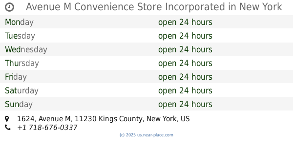
Avenue M Convenience Store Incorporated
1624 Avenue M, Brooklyn
Convenience store
read more
📑
all categories
Accounting
Administrative area level 1
Administrative area level 2
Airport
Amusement park
Aquarium
Art gallery
Atm
Bakery
Bank
Bar
Beauty salon
Bicycle store
Book store
Bowling alley
Bus station
Cafe
Campground
Car dealer
Car rental
Car repair
Car wash
Casino
Cemetery
Church
City hall
Clothing store
Colloquial area
Convenience store
Courthouse
Dentist
Department store
Doctor
Electrician
Electronics store
Embassy
Establishment
Finance
Fire station
Florist
Food
Funeral home
Furniture store
Gas station
General contractor
Grocery or supermarket
Gym
Hair care
Hardware store
Health
Hindu Temple
Home goods store
Hospital
Insurance agency
Intersection
Jewelry store
Laundry
Lawyer
Library
Light rail station
Liquor store
Local government office
Locality
Locksmith
Lodging
Meal delivery
Meal takeaway
Mosque
Movie rental
Movie theater
Moving company
Museum
Natural feature
Neighborhood
Night club
Painter
Park
Parking
Pet store
Pharmacy
Physiotherapist
Place of worship
Plumber
Point of interest
Police
Political
Post office
Premise
Real estate agency
Restaurant
Roofing contractor
Route
Rv park, camping
School
Shoe store
Shopping mall
Spa
Stadium
Storage
Store
Subpremise
Subway station
Supermarket
Synagogue
Taxi stand
Train station
Transit station
Travel agency
University
Veterinary care
Zoo
administrative area level 3
sublocality level 1
↑