Establishment nearby OH in DDS
United States
Establishment nearby OH in DDS
OH in DDS
10, Tomahawk Lane, 90745, Carson, Los Angeles County, US United States
contacts phone
:
+1 310-619-9825
Latitude:
33.8148542
, Longitude:
-118.2633793
larger map & directions
read more
nearest Establishment
234 m
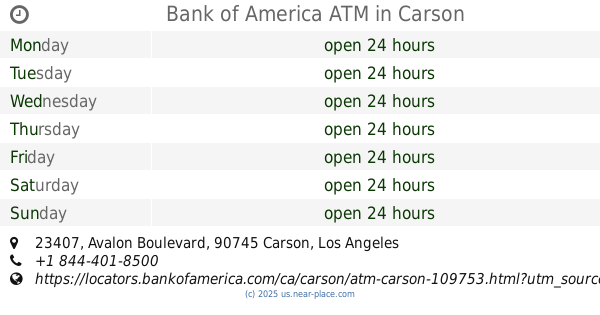
Bank of America ATM
23407 Avalon Boulevard, Carson
Atm
Finance
Point of interest
Establishment
read more
924 m
Carson Laboratories Inc
1031 East Watson Center Road, Carson
Dentist
Health
Point of interest
Establishment
read more
1.083 km
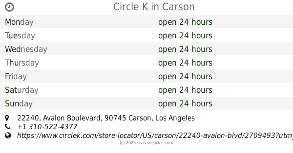
Circle K
22240 Avalon Boulevard, Carson
Convenience store
Gas station
Cafe
Atm
Finance
Store
Food
Point of interest
Establishment
read more
1.13 km
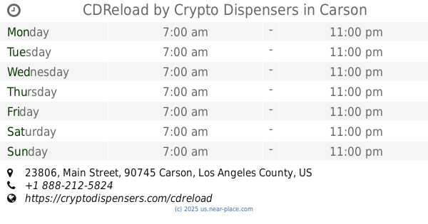
CDReload by Crypto Dispensers
23806 Main Street, Carson
Atm
Finance
Point of interest
Establishment
read more
1.427 km
Mita and Coco
112 West 225th Street, Carson
Lodging
Point of interest
Establishment
read more
1.836 km
ATM
860 Carson Street, Carson
Atm
Finance
Point of interest
Establishment
read more
1.865 km
Hiccups
552 Carson Street #103, Carson
Cafe
Restaurant
Food
Point of interest
Store
Establishment
read more
1.911 km
The Dentist
22015 South Main Street, Carson
Dentist
Health
Point of interest
Establishment
read more
1.984 km
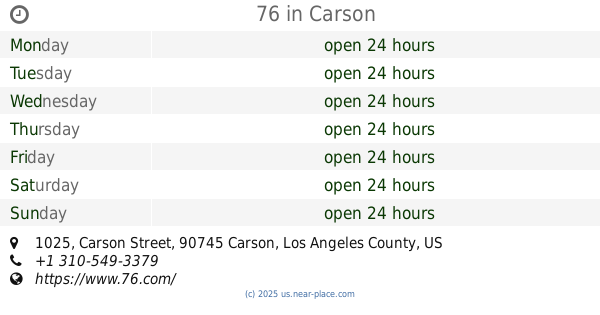
76
1025 Carson Street, Carson
Gas station
Atm
Finance
Point of interest
Establishment
read more
1.999 km
ATM (Carson Unocal 76)
1025 Carson Street, Carson
Atm
Finance
Point of interest
Establishment
read more
2.104 km
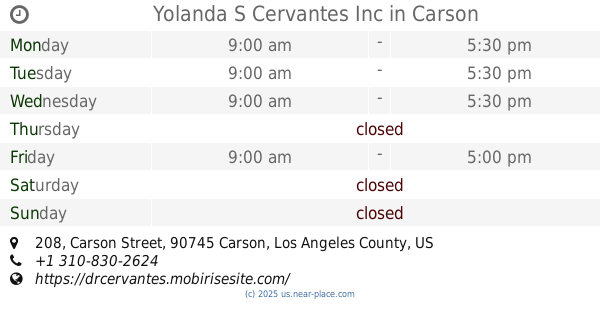
Yolanda S Cervantes Inc
208 Carson Street Ste 200, Carson
Dentist
Health
Point of interest
Establishment
read more
2.22 km
Panacearituals
21735 South Main Street, Carson
Cafe
Food
Point of interest
Establishment
read more
2.331 km
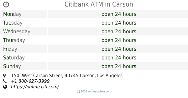
Citibank ATM
150 West Carson Street, Carson
Atm
Finance
Point of interest
Establishment
read more
2.371 km
Dr. Omid Barkhordar
101 West Carson Street, Carson
Dentist
Point of interest
Health
Establishment
read more
2.473 km
Carson Dental Care
240 West Carson Street, Carson
Dentist
Health
Point of interest
Establishment
read more
📑
all categories
Accounting
Administrative area level 1
Administrative area level 2
Airport
Amusement park
Aquarium
Art gallery
Atm
Bakery
Bank
Bar
Beauty salon
Bicycle store
Book store
Bowling alley
Bus station
Cafe
Campground
Car dealer
Car rental
Car repair
Car wash
Casino
Cemetery
Church
City hall
Clothing store
Colloquial area
Convenience store
Courthouse
Dentist
Department store
Doctor
Electrician
Electronics store
Embassy
Establishment
Finance
Fire station
Florist
Food
Funeral home
Furniture store
Gas station
General contractor
Grocery or supermarket
Gym
Hair care
Hardware store
Health
Hindu Temple
Home goods store
Hospital
Insurance agency
Intersection
Jewelry store
Laundry
Lawyer
Library
Light rail station
Liquor store
Local government office
Locality
Locksmith
Lodging
Meal delivery
Meal takeaway
Mosque
Movie rental
Movie theater
Moving company
Museum
Natural feature
Neighborhood
Night club
Painter
Park
Parking
Pet store
Pharmacy
Physiotherapist
Place of worship
Plumber
Point of interest
Police
Political
Post office
Premise
Real estate agency
Restaurant
Roofing contractor
Route
Rv park, camping
School
Shoe store
Shopping mall
Spa
Stadium
Storage
Store
Subpremise
Subway station
Supermarket
Synagogue
Taxi stand
Train station
Transit station
Travel agency
University
Veterinary care
Zoo
administrative area level 3
sublocality level 1
↑