Electronics store nearby Walgreens Photo
United States
Electronics store nearby Walgreens Photo
Walgreens Photo
2024, West Main Street, 85201, Mesa, Maricopa County, US United States
contacts phone
:
+1 480-214-0374
website:
www.walgreens.com
Latitude:
33.4153277
, Longitude:
-111.8753249
larger map & directions
read more
nearest Electronics store
133 m
T-Mobile
20 South Dobson Road, Mesa
Electronics store
read more
627 m
Underdog Studios
65 South Sycamore #1B, Mesa
Electronics store
read more
681 m
Opacs Inc
318 South Dobson Road, Mesa
Electronics store
read more
1.028 km
88.7 FM The Pulse
1601 West Main Street, Mesa
Electronics store
read more
1.22 km
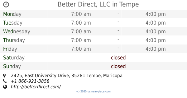
Better Direct, LLC
2425 East University Drive, Tempe
Electronics store
read more
1.401 km
Tv's Harri's Hd
2620 West Broadway Road # 5, Mesa
Electronics store
read more
1.503 km
Used Car dealers
1427 West Broadway Road, Mesa
Electronics store
read more
1.632 km
aCoupleaTechs
1225 West Main Street #101, Mesa
Electronics store
read more
1.695 km
Severtson Corporation
216 South Alma School Road # 3, Mesa
Electronics store
read more
1.7 km
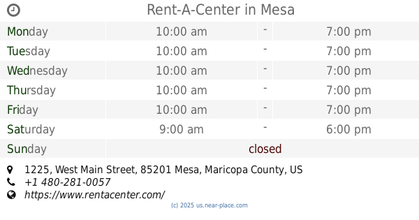
Rent-A-Center
1225 West Main Street, Mesa
Electronics store
read more
1.768 km
Lucky 6 Records
35 North Alma School Road, Mesa
Electronics store
read more
2.04 km
Walmart Photo Center
857 North Dobson Road, Mesa
Electronics store
read more
2.114 km
Lightning Audio Corporation
2055 East 6th Street, Tempe
Electronics store
read more
2.253 km
King's Strings
1108 West 6th Street, Mesa
Electronics store
read more
2.362 km
Flexi
834 South Alma School Road #2, Mesa
Electronics store
read more
📑
all categories
Accounting
Administrative area level 1
Administrative area level 2
Airport
Amusement park
Aquarium
Art gallery
Atm
Bakery
Bank
Bar
Beauty salon
Bicycle store
Book store
Bowling alley
Bus station
Cafe
Campground
Car dealer
Car rental
Car repair
Car wash
Casino
Cemetery
Church
City hall
Clothing store
Colloquial area
Convenience store
Courthouse
Dentist
Department store
Doctor
Electrician
Electronics store
Embassy
Establishment
Finance
Fire station
Florist
Food
Funeral home
Furniture store
Gas station
General contractor
Grocery or supermarket
Gym
Hair care
Hardware store
Health
Hindu Temple
Home goods store
Hospital
Insurance agency
Intersection
Jewelry store
Laundry
Lawyer
Library
Light rail station
Liquor store
Local government office
Locality
Locksmith
Lodging
Meal delivery
Meal takeaway
Mosque
Movie rental
Movie theater
Moving company
Museum
Natural feature
Neighborhood
Night club
Painter
Park
Parking
Pet store
Pharmacy
Physiotherapist
Place of worship
Plumber
Point of interest
Police
Political
Post office
Premise
Real estate agency
Restaurant
Roofing contractor
Route
Rv park, camping
School
Shoe store
Shopping mall
Spa
Stadium
Storage
Store
Subpremise
Subway station
Supermarket
Synagogue
Taxi stand
Train station
Transit station
Travel agency
University
Veterinary care
Zoo
administrative area level 3
sublocality level 1
↑