Convenience store nearby 7-Eleven
United States
Convenience store nearby 7-Eleven
7-Eleven
146, Empire Boulevard, 11225, Kings County, New York, US Соединенные Штаты Америки
contacts phone
:
+1 718-469-0726
website:
www.7-eleven.com
Latitude:
40.6631611
, Longitude:
-73.9574115
larger map & directions
read more
nearest Convenience store
251 m
Rite Aid
1679 Bedford Avenue, Brooklyn
Convenience store
read more
578 m
Carroll St Discount Corp
888 Franklin Avenue, Brooklyn
Convenience store
read more
717 m
Crown Heights Deli
902 Nostrand Avenue, Brooklyn
Convenience store
read more
735 m
LateNightXpress.com
1198 Carroll Street, Brooklyn
Convenience store
read more
770 m
African Caribbean Phone Card
816 Franklin Avenue, Brooklyn
Convenience store
read more
832 m
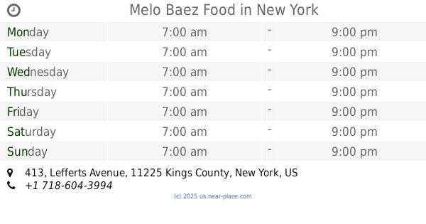
Melo Baez Food
413 Lefferts Avenue, Brooklyn
Convenience store
read more
894 m
Crown Heghts Convenience Inc
803 Nostrand Avenue, Brooklyn
Convenience store
read more
951 m
Aissatou Mini Mart
788 Franklin Avenue, Brooklyn
Convenience store
read more
971 m
CVS
1251 Nostrand Avenue, Brooklyn
Convenience store
read more
1.138 km
Downstate Gas & Food Inc
720 New York Avenue, Brooklyn
Convenience store
read more
1.198 km
Duane Reade
750 New York Avenue, Brooklyn
Convenience store
read more
1.482 km
Lily Food Mart
2837 Church Avenue, Brooklyn
Convenience store
read more
1.963 km
Zam Zam Stop & Stop Store
1184 Fulton Street, Brooklyn
Convenience store
read more
1.992 km
General Merchandise
1263 Saint Johns Place, Brooklyn
Convenience store
read more
2.527 km
Bolla market
3132 Fort Hamilton Parkway, Brooklyn
Convenience store
read more
📑
all categories
Accounting
Administrative area level 1
Administrative area level 2
Airport
Amusement park
Aquarium
Art gallery
Atm
Bakery
Bank
Bar
Beauty salon
Bicycle store
Book store
Bowling alley
Bus station
Cafe
Campground
Car dealer
Car rental
Car repair
Car wash
Casino
Cemetery
Church
City hall
Clothing store
Colloquial area
Convenience store
Courthouse
Dentist
Department store
Doctor
Electrician
Electronics store
Embassy
Establishment
Finance
Fire station
Florist
Food
Funeral home
Furniture store
Gas station
General contractor
Grocery or supermarket
Gym
Hair care
Hardware store
Health
Hindu Temple
Home goods store
Hospital
Insurance agency
Intersection
Jewelry store
Laundry
Lawyer
Library
Light rail station
Liquor store
Local government office
Locality
Locksmith
Lodging
Meal delivery
Meal takeaway
Mosque
Movie rental
Movie theater
Moving company
Museum
Natural feature
Neighborhood
Night club
Painter
Park
Parking
Pet store
Pharmacy
Physiotherapist
Place of worship
Plumber
Point of interest
Police
Political
Post office
Premise
Real estate agency
Restaurant
Roofing contractor
Route
Rv park, camping
School
Shoe store
Shopping mall
Spa
Stadium
Storage
Store
Subpremise
Subway station
Supermarket
Synagogue
Taxi stand
Train station
Transit station
Travel agency
University
Veterinary care
Zoo
administrative area level 3
sublocality level 1
↑