Park nearby Kossuth Street Garden
Coronavirus disease (COVID-19) Situation
confirmed cases
111820082
deaths
1219487
United States
Park nearby Kossuth Street Garden
Kossuth Street Garden
Columbus United States
contacts phone
:
+1
Latitude:
39.9455167
, Longitude:
-82.9793861
read more
nearest Park
220 m
Kobacker Park
570 East Kossuth Street, Columbus
Park
read more
474 m
Martin Park
Columbus
Park
read more
693 m
Livingston Park
Columbus
Park
read more
1.011 km
Chic Harley Memorial Garden
689 South Champion Avenue, Columbus
Park
read more
1.045 km
Karns Park
Columbus
Park
read more
1.045 km
Parsons Community Garden
1309 Parsons Avenue, Columbus
Park
read more
1.168 km
Schiller Park
1069 Jaeger Street, Columbus
Park
read more
1.236 km
FRANK FETCH PARK
228 East Beck Street, Columbus
Park
read more
1.289 km
Moeller Park
Columbus
Park
read more
1.31 km
Roosevelt Park
Columbus
Park
read more
1.467 km
Blackburn Park
263 Carpenter Street, Columbus
Park
read more
1.681 km
Linwood Park
473 Linwood Avenue, Columbus
Park
read more
1.773 km
Lincoln Park
1700 South 20th Street, Columbus
Park
read more
1.8 km
Four Seasons City Farm
1101 Bryden Road, Columbus
Park
read more
1.853 km
Deshler Park
Columbus
Park
read more
1.872 km
Topiary Park
480 East Town Street, Columbus
Park
read more
1.916 km
Mound Street Community Garden
50 East Mound Street, Columbus
Park
read more
1.922 km
OTE Community Garden
26 South Garfield Avenue, Columbus
Park
read more
1.924 km
Franklin Commons
Columbus
Park
read more
1.966 km
Cole St. Garden
611 Kelton Avenue, Columbus
Park
read more
2.029 km
Kwanzaa Playground
1277 Bryden Road, Columbus
Park
read more
2.148 km
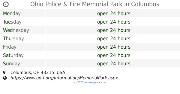
Ohio Police & Fire Memorial Park
Columbus
Park
read more
2.154 km
Columbus Commons Carousel
Columbus
Park
read more
2.263 km
John F. Wolfe Columbus Commons
160 South High Street, Columbus
Park
read more
2.477 km
Capitol Square
75 East State Street, Columbus
Park
read more
📑
all categories
Accounting
Administrative area level 1
Administrative area level 2
Airport
Amusement park
Aquarium
Art gallery
Atm
Bakery
Bank
Bar
Beauty salon
Bicycle store
Book store
Bowling alley
Bus station
Cafe
Campground
Car dealer
Car rental
Car repair
Car wash
Casino
Cemetery
Church
City hall
Clothing store
Colloquial area
Convenience store
Courthouse
Dentist
Department store
Doctor
Electrician
Electronics store
Embassy
Establishment
Finance
Fire station
Florist
Food
Funeral home
Furniture store
Gas station
General contractor
Grocery or supermarket
Gym
Hair care
Hardware store
Health
Hindu Temple
Home goods store
Hospital
Insurance agency
Intersection
Jewelry store
Laundry
Lawyer
Library
Light rail station
Liquor store
Local government office
Locality
Locksmith
Lodging
Meal delivery
Meal takeaway
Mosque
Movie rental
Movie theater
Moving company
Museum
Natural feature
Neighborhood
Night club
Painter
Park
Parking
Pet store
Pharmacy
Physiotherapist
Place of worship
Plumber
Point of interest
Police
Political
Post office
Premise
Real estate agency
Restaurant
Roofing contractor
Route
Rv park, camping
School
Shoe store
Shopping mall
Spa
Stadium
Storage
Store
Subpremise
Subway station
Supermarket
Synagogue
Taxi stand
Train station
Transit station
Travel agency
University
Veterinary care
Zoo
administrative area level 3
sublocality level 1
↑