Gas station nearby Suntown Mart
Coronavirus disease (COVID-19) Situation
confirmed cases
111820082
deaths
1219487
United States
Gas station nearby Suntown Mart
Suntown Mart
1760 East Elliot Road, Tempe United States
contacts phone
:
+1
Latitude:
33.349555
, Longitude:
-111.911704
read more
nearest Gas station
4 m
Fry's Fuel Center
1760 East Elliot Road, Tempe
Gas station
read more
97 m
Shell
7602 South McClintock Drive, Tempe
Gas station
read more
1.717 km
Shell
8805 South McClintock Drive, Tempe
Gas station
read more
3.213 km
Shell
4020 West Ray Road, Chandler
Gas station
read more
3.486 km
Valero
480 West Warner Road, Tempe
Gas station
read more
3.552 km
K
United States
Gas station
read more
3.552 km
K
Chandler
Gas station
read more
3.591 km
Fry's Fuel Center
9970 South Rural Road, Tempe
Gas station
read more
3.626 km
Shell
505 West Warner Road, Tempe
Gas station
read more
3.691 km
bela cruz
R. Miguel Lopes - Jardim Lídia, São Paulo
Gas station
read more
3.918 km
Shell
995 West Elliot Road, Tempe
Gas station
read more
4.343 km
Shell
8810 South Hardy Drive, Tempe
Gas station
read more
4.516 km
Chevron
616 West Baseline Road, Tempe
Gas station
read more
4.589 km
Costco Gasoline
1445 West Elliot Road, Tempe
Gas station
read more
4.824 km
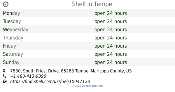
Shell
7530 South Priest Drive, Tempe
Gas station
read more
5.042 km
Kroger Fuel
Gas station
read more
5.088 km
QuikTrip
2195 East Southern Avenue, Tempe
Gas station
read more
5.544 km
Fry's Fuel Center
34 West Southern Avenue, Tempe
Gas station
read more
5.752 km
Chevron
1205 West Baseline Road, Mesa
Gas station
read more
5.757 km
4 Sons
1250 South Alma School Road, Mesa
Gas station
read more
5.837 km
Shell
1619 West Baseline Road, Tempe
Gas station
read more
5.951 km
Thrifty Oil Co
2012 West Southern Avenue, Mesa
Gas station
read more
6.31 km
QuikTrip
3875 South Priest Drive, Tempe
Gas station
read more
6.816 km
Phoenix Fuel
7005 West Detroit Street, Chandler
Gas station
read more
6.84 km
Chevron
7000 West Chandler Boulevard, Chandler
Gas station
read more
📑
all categories
Accounting
Administrative area level 1
Administrative area level 2
Airport
Amusement park
Aquarium
Art gallery
Atm
Bakery
Bank
Bar
Beauty salon
Bicycle store
Book store
Bowling alley
Bus station
Cafe
Campground
Car dealer
Car rental
Car repair
Car wash
Casino
Cemetery
Church
City hall
Clothing store
Colloquial area
Convenience store
Courthouse
Dentist
Department store
Doctor
Electrician
Electronics store
Embassy
Establishment
Finance
Fire station
Florist
Food
Funeral home
Furniture store
Gas station
General contractor
Grocery or supermarket
Gym
Hair care
Hardware store
Health
Hindu Temple
Home goods store
Hospital
Insurance agency
Intersection
Jewelry store
Laundry
Lawyer
Library
Light rail station
Liquor store
Local government office
Locality
Locksmith
Lodging
Meal delivery
Meal takeaway
Mosque
Movie rental
Movie theater
Moving company
Museum
Natural feature
Neighborhood
Night club
Painter
Park
Parking
Pet store
Pharmacy
Physiotherapist
Place of worship
Plumber
Point of interest
Police
Political
Post office
Premise
Real estate agency
Restaurant
Roofing contractor
Route
Rv park, camping
School
Shoe store
Shopping mall
Spa
Stadium
Storage
Store
Subpremise
Subway station
Supermarket
Synagogue
Taxi stand
Train station
Transit station
Travel agency
University
Veterinary care
Zoo
administrative area level 3
sublocality level 1
↑