Gas station nearby QuikTrip
Coronavirus disease (COVID-19) Situation
confirmed cases
111820082
deaths
1219487
United States
Gas station nearby QuikTrip
QuikTrip
1545 North Scottsdale Road, Tempe United States
contacts phone
:
+1
Latitude:
33.4471265
, Longitude:
-111.9258228
read more
nearest Gas station
416 m
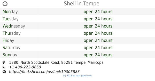
Shell
1380 North Scottsdale Road, Tempe
Gas station
read more
420 m
Carioca Co
1380 North Scottsdale Road, Tempe
Gas station
read more
2.174 km
Zigi Gas
60 East Rio Salado Parkway, Tempe
Gas station
read more
2.814 km
Phoenix Fuel Co Inc
106 South Perry Lane, Tempe
Gas station
read more
2.827 km
Chevron
809 South Rural Road, Tempe
Gas station
read more
3.113 km
Jacksons Food Store
2096 East Rio Salado Parkway, Tempe
Gas station
read more
3.129 km
Shell
2090 East Rio Salado Parkway, Tempe
Gas station
read more
3.281 km
The Joint Smokeshop
Tempe
Gas station
read more
3.639 km
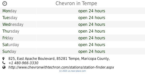
Chevron
825 East Apache Boulevard, Tempe
Gas station
read more
3.656 km
ARCO
980 West University Drive, Tempe
Gas station
read more
4.008 km
QuikTrip
2150 East University Drive, Tempe
Gas station
read more
4.141 km
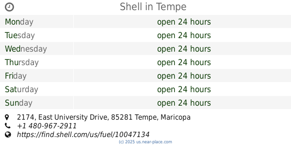
Shell
2174 East University Drive, Tempe
Gas station
read more
4.312 km
QuikTrip Phoenix Division Office
1116 East Broadway Road, Tempe
Gas station
read more
4.35 km
Shell
808 South Priest Drive, Tempe
Gas station
read more
4.374 km
QuikTrip
1106 East Broadway Road, Tempe
Gas station
read more
4.634 km
Chevron
1808 East Broadway Road, Tempe
Gas station
read more
4.785 km
Shell & Camper Center
2183 Apache Boulevard, Tempe
Gas station
read more
5.049 km
QuikTrip
2111 West University Drive, Tempe
Gas station
read more
5.186 km
Corner Store Market
813 North Dobson Road, Mesa
Gas station
read more
5.415 km
Aeroteams
521 South 48th Street, Tempe
Gas station
read more
5.512 km
Mobil
2015 West University Drive, Mesa
Gas station
read more
6.389 km
QuikTrip
2026 West Broadway Road, Mesa
Gas station
read more
6.465 km
Shell
2005 W Broadway Rd, Mesa
Gas station
read more
6.594 km
Shell
4252 South 48th Street, Phoenix
Gas station
read more
6.67 km
Chevron
4737 East Broadway Road, Phoenix
Gas station
read more
📑
all categories
Accounting
Administrative area level 1
Administrative area level 2
Airport
Amusement park
Aquarium
Art gallery
Atm
Bakery
Bank
Bar
Beauty salon
Bicycle store
Book store
Bowling alley
Bus station
Cafe
Campground
Car dealer
Car rental
Car repair
Car wash
Casino
Cemetery
Church
City hall
Clothing store
Colloquial area
Convenience store
Courthouse
Dentist
Department store
Doctor
Electrician
Electronics store
Embassy
Establishment
Finance
Fire station
Florist
Food
Funeral home
Furniture store
Gas station
General contractor
Grocery or supermarket
Gym
Hair care
Hardware store
Health
Hindu Temple
Home goods store
Hospital
Insurance agency
Intersection
Jewelry store
Laundry
Lawyer
Library
Light rail station
Liquor store
Local government office
Locality
Locksmith
Lodging
Meal delivery
Meal takeaway
Mosque
Movie rental
Movie theater
Moving company
Museum
Natural feature
Neighborhood
Night club
Painter
Park
Parking
Pet store
Pharmacy
Physiotherapist
Place of worship
Plumber
Point of interest
Police
Political
Post office
Premise
Real estate agency
Restaurant
Roofing contractor
Route
Rv park, camping
School
Shoe store
Shopping mall
Spa
Stadium
Storage
Store
Subpremise
Subway station
Supermarket
Synagogue
Taxi stand
Train station
Transit station
Travel agency
University
Veterinary care
Zoo
administrative area level 3
sublocality level 1
↑