Convenience store nearby Circle K
Coronavirus disease (COVID-19) Situation
confirmed cases
111820082
deaths
1219487
United States
Convenience store nearby Circle K
Circle K
620 East Carefree Highway, Phoenix United States
contacts phone
:
+1
Latitude:
33.7995891
, Longitude:
-112.0661039
read more
nearest Convenience store
168 m
4 Sons Food Stores
445 East Carefree Highway, Phoenix
Convenience store
read more
4.882 km
Walgreens
2707 West Carefree Highway, Phoenix
Convenience store
read more
5.642 km
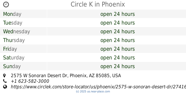
Circle K
2575 W Sonoran Desert Dr, Phoenix
Convenience store
read more
7.43 km
CVS
28635 North North Valley Parkway, Phoenix
Convenience store
read more
8.095 km
CVS
39510 North Gavilan Peak Parkway, Anthem
Convenience store
read more
8.191 km
Circle K
39414 West Daisy Mountain Drive, Anthem
Convenience store
read more
10.055 km
Circle K
1850 West Happy Valley Road, Phoenix
Convenience store
read more
11.657 km
Circle K
24838 North 35th Avenue, Glendale
Convenience store
read more
13.115 km
4 Sons Food Stores
3610 West Pinnacle Peak Road, Glendale
Convenience store
read more
13.487 km
Circle K
2311 West Deer Valley Road, Phoenix
Convenience store
read more
13.697 km
Circle K
2702 West Deer Valley Road, Phoenix
Convenience store
read more
13.769 km
ampm
2635 West Deer Valley Road, Phoenix
Convenience store
read more
14.105 km
ampm
20838 North 19th Avenue, Phoenix
Convenience store
read more
14.141 km
CVS
5450 West Happy Valley Road, Phoenix
Convenience store
read more
14.384 km
Circle K
3435 West Deer Valley Road, Phoenix
Convenience store
read more
14.572 km
Circle K
20202 North 7th Avenue, Phoenix
Convenience store
read more
14.731 km
Circle K
19830 North 7th Street, Phoenix
Convenience store
read more
14.807 km
Circle K
2359 East Beardsley Road, Phoenix
Convenience store
read more
15.454 km
7-Eleven
19848 North 27th Avenue, Phoenix
Convenience store
read more
15.659 km
Jacksons Food Stores
21001 North Tatum Boulevard #4, Phoenix
Convenience store
read more
15.75 km
CVS
21001 North Tatum Boulevard, Phoenix
Convenience store
read more
15.811 km
Walgreens
4710 East Rose Garden Lane, Phoenix
Convenience store
read more
15.864 km
Walgreens
6640 West Happy Valley Road, Glendale
Convenience store
read more
18.085 km
Walgreens
22280 North 67th Avenue, Glendale
Convenience store
read more
18.243 km
Circle K
20207 North 59th Avenue, Glendale
Convenience store
read more
📑
all categories
Accounting
Administrative area level 1
Administrative area level 2
Airport
Amusement park
Aquarium
Art gallery
Atm
Bakery
Bank
Bar
Beauty salon
Bicycle store
Book store
Bowling alley
Bus station
Cafe
Campground
Car dealer
Car rental
Car repair
Car wash
Casino
Cemetery
Church
City hall
Clothing store
Colloquial area
Convenience store
Courthouse
Dentist
Department store
Doctor
Electrician
Electronics store
Embassy
Establishment
Finance
Fire station
Florist
Food
Funeral home
Furniture store
Gas station
General contractor
Grocery or supermarket
Gym
Hair care
Hardware store
Health
Hindu Temple
Home goods store
Hospital
Insurance agency
Intersection
Jewelry store
Laundry
Lawyer
Library
Light rail station
Liquor store
Local government office
Locality
Locksmith
Lodging
Meal delivery
Meal takeaway
Mosque
Movie rental
Movie theater
Moving company
Museum
Natural feature
Neighborhood
Night club
Painter
Park
Parking
Pet store
Pharmacy
Physiotherapist
Place of worship
Plumber
Point of interest
Police
Political
Post office
Premise
Real estate agency
Restaurant
Roofing contractor
Route
Rv park, camping
School
Shoe store
Shopping mall
Spa
Stadium
Storage
Store
Subpremise
Subway station
Supermarket
Synagogue
Taxi stand
Train station
Transit station
Travel agency
University
Veterinary care
Zoo
administrative area level 3
sublocality level 1
↑