Convenience store nearby Circle K
Coronavirus disease (COVID-19) Situation
confirmed cases
111820082
deaths
1219487
United States
Convenience store nearby Circle K
Circle K
1250, East Chandler Boulevard, 85048, Phoenix, Maricopa County, US United States
contacts phone
:
+1 480-460-3051
website:
www.circlek.com
Latitude:
33.306317
, Longitude:
-112.055913
larger map & directions
read more
nearest Convenience store
157 m
Walgreens
1315 East Chandler Boulevard, Phoenix
Convenience store
read more
203 m
Chris' Water & Ice
1334 East Chandler Boulevard, Phoenix
Convenience store
read more
318 m
4 Sons Food Stores
1446 East Chandler Boulevard, Phoenix
Convenience store
read more
3.86 km
Circle K
3201 East Chandler Boulevard, Phoenix
Convenience store
read more
7.327 km
Circle K
4950 East Chandler Boulevard, Phoenix
Convenience store
read more
7.914 km
Walgreens
7606 South 7th Street, Phoenix
Convenience store
read more
7.968 km
Circle K
5060 Warner Road, Phoenix
Convenience store
read more
8.167 km
Circle K
7351 West Chandler Boulevard, Chandler
Convenience store
read more
9.95 km
Circle K
7530 South Priest Drive, Tempe
Convenience store
read more
10.757 km
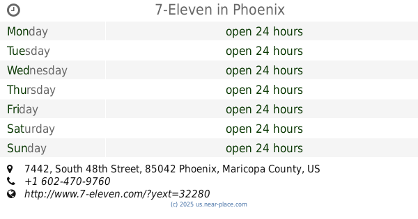
7-Eleven
7442 South 48th Street, Phoenix
Convenience store
read more
11.191 km
Circle K
1540 East Broadway Road, Phoenix
Convenience store
read more
11.501 km
AMPM
702 West Broadway Road, Phoenix
Convenience store
read more
11.835 km
Circle K
3151 East Broadway Road, Phoenix
Convenience store
read more
11.845 km
Circle K
1435 West Baseline Road, Tempe
Convenience store
read more
12.656 km
Simply Pure Markets LLC
110 West Orion Street #143, Tempe
Convenience store
read more
12.671 km
CVS
855 East Elliot Road, Tempe
Convenience store
read more
13.076 km
CVS
5050 West Baseline Road, Laveen Village
Convenience store
read more
13.389 km
Circle K
4252 South 48th Street, Phoenix
Convenience store
read more
14.13 km
Circle K
5240 South Rural Road, Tempe
Convenience store
read more
14.453 km
Circle K
15 West Southern Avenue, Tempe
Convenience store
read more
14.819 km
Circle K
3501 West Lower Buckeye Road, Phoenix
Convenience store
read more
15.115 km
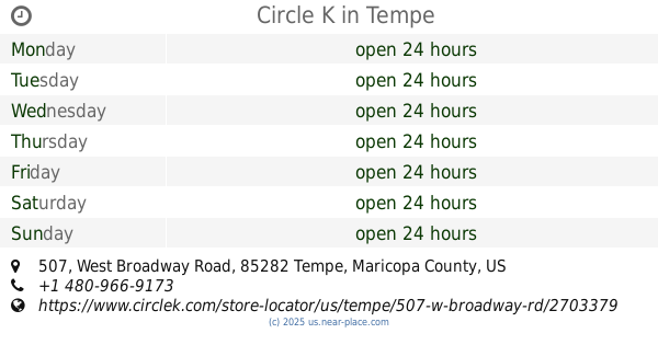
Circle K
507 West Broadway Road, Tempe
Convenience store
read more
16.114 km
ampm
3416, 980 West University Drive, Tempe
Convenience store
read more
16.602 km
Circle K
5041 West Lower Buckeye Road, Phoenix
Convenience store
read more
18.747 km
Circle K
1802 East University Drive, Tempe
Convenience store
read more
📑
all categories
Accounting
Administrative area level 1
Administrative area level 2
Airport
Amusement park
Aquarium
Art gallery
Atm
Bakery
Bank
Bar
Beauty salon
Bicycle store
Book store
Bowling alley
Bus station
Cafe
Campground
Car dealer
Car rental
Car repair
Car wash
Casino
Cemetery
Church
City hall
Clothing store
Colloquial area
Convenience store
Courthouse
Dentist
Department store
Doctor
Electrician
Electronics store
Embassy
Establishment
Finance
Fire station
Florist
Food
Funeral home
Furniture store
Gas station
General contractor
Grocery or supermarket
Gym
Hair care
Hardware store
Health
Hindu Temple
Home goods store
Hospital
Insurance agency
Intersection
Jewelry store
Laundry
Lawyer
Library
Light rail station
Liquor store
Local government office
Locality
Locksmith
Lodging
Meal delivery
Meal takeaway
Mosque
Movie rental
Movie theater
Moving company
Museum
Natural feature
Neighborhood
Night club
Painter
Park
Parking
Pet store
Pharmacy
Physiotherapist
Place of worship
Plumber
Point of interest
Police
Political
Post office
Premise
Real estate agency
Restaurant
Roofing contractor
Route
Rv park, camping
School
Shoe store
Shopping mall
Spa
Stadium
Storage
Store
Subpremise
Subway station
Supermarket
Synagogue
Taxi stand
Train station
Transit station
Travel agency
University
Veterinary care
Zoo
administrative area level 3
sublocality level 1
↑