Bakery nearby Safeway Bakery
United States
Bakery nearby Safeway Bakery
Safeway Bakery
Wheat Ridge Forenede Stater
contacts phone
:
+1
Latitude:
39.7712819
, Longitude:
-105.0798192
read more
nearest Bakery
401 m
Vinnola's Italian Market
7750 West 38th Avenue, Wheat Ridge
Bakery
read more
420 m
Meraki Cakes & Bakes
4836, 7043 West 38th Avenue, Wheat Ridge
Bakery
read more
969 m
Dolce Sicilia Italian Bakery
3210 Wadsworth Boulevard, Wheat Ridge
Bakery
read more
1.149 km
Kings Norsk Products
3905 Dover Street, Wheat Ridge
Bakery
read more
1.811 km
Walmart Bakery
5957 West 44th Avenue, Denver
Bakery
read more
2.231 km
Gargaro's Italian Bakery
5058 Marshall Street, Arvada
Bakery
read more
2.684 km
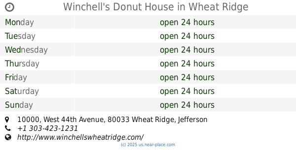
Winchell's Donut House
10000 West 44th Avenue, Wheat Ridge
Cafe
Bakery
Store
Restaurant
Food
Point of interest
Establishment
read more
2.876 km
Cold Stone Creamery
5545 Wadsworth Bypass Ste D, Arvada
Bakery
read more
3.089 km
The Pasty Republic
4166 Tennyson Street, Denver
Bakery
read more
3.245 km
Cosmo's the Retail Store
10111 West 26th Avenue #101, Wheat Ridge
Bakery
read more
3.33 km
Leroy's Bagels
4432 West 29th Avenue, Denver
Bakery
read more
3.382 km
Einstein Bros. Bagels
5131 Kipling Street #610, Wheat Ridge
Cafe
Bakery
Restaurant
Food
Point of interest
Store
Establishment
read more
4.944 km
Village Inn
4850 Federal Boulevard, Denver
Bakery
read more
4.956 km
Winchell's
4965 Federal Boulevard, Denver
Bakery
read more
5.161 km
Cake Depot
3000 West 23rd Avenue, Denver
Bakery
read more
📑
all categories
Accounting
Administrative area level 1
Administrative area level 2
Airport
Amusement park
Aquarium
Art gallery
Atm
Bakery
Bank
Bar
Beauty salon
Bicycle store
Book store
Bowling alley
Bus station
Cafe
Campground
Car dealer
Car rental
Car repair
Car wash
Casino
Cemetery
Church
City hall
Clothing store
Colloquial area
Convenience store
Courthouse
Dentist
Department store
Doctor
Electrician
Electronics store
Embassy
Establishment
Finance
Fire station
Florist
Food
Funeral home
Furniture store
Gas station
General contractor
Grocery or supermarket
Gym
Hair care
Hardware store
Health
Hindu Temple
Home goods store
Hospital
Insurance agency
Intersection
Jewelry store
Laundry
Lawyer
Library
Light rail station
Liquor store
Local government office
Locality
Locksmith
Lodging
Meal delivery
Meal takeaway
Mosque
Movie rental
Movie theater
Moving company
Museum
Natural feature
Neighborhood
Night club
Painter
Park
Parking
Pet store
Pharmacy
Physiotherapist
Place of worship
Plumber
Point of interest
Police
Political
Post office
Premise
Real estate agency
Restaurant
Roofing contractor
Route
Rv park, camping
School
Shoe store
Shopping mall
Spa
Stadium
Storage
Store
Subpremise
Subway station
Supermarket
Synagogue
Taxi stand
Train station
Transit station
Travel agency
University
Veterinary care
Zoo
administrative area level 3
sublocality level 1
↑