Atm nearby Parking Lot Pay By Phone
Coronavirus disease (COVID-19) Situation
confirmed cases
111820082
deaths
1219487
United States
Atm nearby Parking Lot Pay By Phone
Parking Lot Pay By Phone
Seattle United States
contacts phone
:
+1
Latitude:
47.6183003
, Longitude:
-122.3341497
read more
nearest Atm
278 m
Community Merchant Services
1828 Yale Avenue, Seattle
Atm
read more
414 m
Cabe and Cato Inc.
2027 Westlake Avenue, Seattle
Atm
read more
505 m
ATM
1635 8th Avenue, Seattle
Atm
read more
575 m
Wells Fargo ATM
2121 6th Avenue, Seattle
Atm
read more
592 m
Premier ATM
1722 Bellevue Avenue, Seattle
Atm
read more
615 m
ATM Express
301 East Pine Street, Seattle
Atm
read more
621 m
ATM
2201 6th Avenue, Seattle
Atm
read more
713 m
Premier ATM
226 Aurora Avenue North, Seattle
Atm
read more
769 m
Automated Financial
400 Pine Street, Seattle
Atm
read more
830 m
ATM
1400 6th Avenue, Seattle
Atm
read more
865 m
Cardtronics ATM
619 East Pine Street, Seattle
Atm
read more
920 m
Cardtronics ATM
1524 3rd Avenue, Seattle
Atm
read more
929 m
HSBC ATM
523 Union Street, Seattle
Atm
read more
950 m
ATM
2226 2nd Avenue, Seattle
Atm
read more
975 m
ATM Express
115 Blanchard Street, Seattle
Atm
read more
980 m
ATM (Us Bank)
135 Broadway, Seattle
Atm
read more
1.031 km
Access to Money
1525 2nd Avenue, Seattle
Atm
read more
1.055 km
Effortless ATMs
2331 2nd Avenue, Seattle
Atm
read more
1.069 km
Fedcorp
1509 Broadway, Seattle
Atm
read more
1.082 km
ATM Express
90 Blanchard Street, Seattle
Atm
read more
1.086 km
Cabe and Cato Inc.
601 Roy Street, Seattle
Atm
read more
1.121 km
Chase ATM
1415 Broadway, Seattle
Atm
read more
1.222 km
ATM (Plaid Pantry)
720 Taylor Avenue North, Seattle
Atm
read more
1.225 km
Sound Credit Union
1109 Madison St, Seattle
Atm
read more
1.271 km
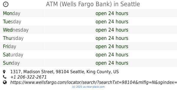
ATM (Wells Fargo Bank)
1317 Madison Street, Seattle
Atm
read more
📑
all categories
Accounting
Administrative area level 1
Administrative area level 2
Airport
Amusement park
Aquarium
Art gallery
Atm
Bakery
Bank
Bar
Beauty salon
Bicycle store
Book store
Bowling alley
Bus station
Cafe
Campground
Car dealer
Car rental
Car repair
Car wash
Casino
Cemetery
Church
City hall
Clothing store
Colloquial area
Convenience store
Courthouse
Dentist
Department store
Doctor
Electrician
Electronics store
Embassy
Establishment
Finance
Fire station
Florist
Food
Funeral home
Furniture store
Gas station
General contractor
Grocery or supermarket
Gym
Hair care
Hardware store
Health
Hindu Temple
Home goods store
Hospital
Insurance agency
Intersection
Jewelry store
Laundry
Lawyer
Library
Light rail station
Liquor store
Local government office
Locality
Locksmith
Lodging
Meal delivery
Meal takeaway
Mosque
Movie rental
Movie theater
Moving company
Museum
Natural feature
Neighborhood
Night club
Painter
Park
Parking
Pet store
Pharmacy
Physiotherapist
Place of worship
Plumber
Point of interest
Police
Political
Post office
Premise
Real estate agency
Restaurant
Roofing contractor
Route
Rv park, camping
School
Shoe store
Shopping mall
Spa
Stadium
Storage
Store
Subpremise
Subway station
Supermarket
Synagogue
Taxi stand
Train station
Transit station
Travel agency
University
Veterinary care
Zoo
administrative area level 3
sublocality level 1
↑